

Roads That Are the Destination: A Fitoornama Guide to the Great Himalayan Routes
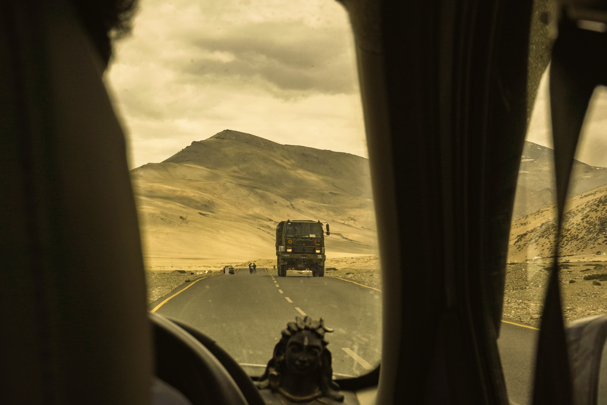
Tough roads lead to beautiful destinations. And when the routes belong to the greater Himalayas, it would be a fool’s idea to speak on their behalf — these roads speak for themselves, and their tales are enchanting, punishing, and prosperous all at once. We’ve spent enough seasons on these stretches, tyres slipping on scree and hands cramped around handlebars, to know that half of what people call a “hidden destination” up here is really just a road nobody warned them about.
This one’s dedicated to every rider and driver who’s ever chosen the long way. Here are our chosen routes, spread across the Great Himalayan ranges — worth doing once, and worth doing again.
A few of these roads ask for nothing more than a full tank and a working ID. Others sit close enough to an international border that the Army wants to know your travel plans before you do. We’ve added what’s actually required for each — carry photocopies of everything, because the one checkpoint that matters is never the one you expected.
On every route, regardless of permits: a valid photo ID (Aadhaar, driving license, or passport), your vehicle’s RC and insurance, and a valid PUC certificate. Keep 4–6 photocopies of each — checkposts rarely have a photocopier, and you will hit more than one.
Guwahati – Tezpur – Dirang – Tawang
North-East India holds some of the best road-trip terrain in the country and remains, even now, one of the last stretches that tourism hasn’t fully caught up with. The classic run from Guwahati to Tawang is long, threaded with sharp hairpins, and not something you finish in a single push — plan for at least one or two night halts along the way. Most riders shorten the haul by getting to Tezpur first, by bus, train, or flight, and starting the real ride from there. Past Tezpur, the road cuts through virgin forest and lush valleys running along the Assam–Arunachal border. This one’s built for riders who already know what they’re doing — not a route to learn on.
Time to visit: March and October
Distance: 536 km
Permits & documents: An Inner Line Permit (ILP) is mandatory for every Indian citizen entering Arunachal Pradesh — this isn’t optional paperwork, it’s checked at Bhalukpong, Bomdila, and again on the approach to Tawang. Apply online at arunachalilp.com (2–5 working days processing) or in person at any Deputy Commissioner’s office; carry two passport photos and a photo ID. Foreign nationals need a Protected Area Permit instead, issued only to registered groups of two or more through a recognised travel agency — solo foreign travel into the state isn’t permitted. Print at least three copies of the ILP; digital copies aren’t accepted at most checkposts.
<iframe src=”https://maps.google.com/maps?saddr=Guwahati,+Assam&daddr=Tezpur,+Assam+to:Dirang,+Arunachal+Pradesh+to:Tawang,+Arunachal+Pradesh&output=embed” width=”900″ height=”450″ style=”border:0″ allowfullscreen loading=”lazy”></iframe>
Manali – Keylong – Baralacha La – Sarchu – Leh
This is the rugged terrain every rider dreams about and very few finish without a story to tell. It’s not a route you cover — it’s a route that covers you. The highway winds through the high Himalayas, crossing some of the world’s highest motorable passes — Rohtang La, Baralacha La, Lachulung La, Tanglang La — and for long stretches, there’s barely a sign of civilisation. Just you, the road, and a wilderness that doesn’t care whether you’re prepared for it. Plan this one properly, or don’t plan it at all.
Time to visit: June to September
Distance: 473 km
Permits & documents: No ILP is needed for Indian citizens travelling this highway itself.
Leh town and the road connecting to it are open. The only mandatory payment is Ladakh’s Ecology Contribution Fee (around ₹590 per person), payable online before arrival. Two separate route choices affect your paperwork out of Manali: crossing Rohtang Pass by road needs a Rohtang Pass / Beyond Rohtang permit (book at rohtangpermits.hp.gov.in, closed Tuesdays); taking the Atal Tunnel instead skips that permit entirely but requires free e-Aagman vehicle registration for entry into Lahaul-Spiti district. If you plan to detour to Pangong, Nubra, or Tso Moriri once past Leh, that’s a separate Inner Line Permit obtainable at the DC office in Leh or online. Foreign nationals need a Protected Area Permit for those same detours.
<iframe src=”https://maps.google.com/maps?saddr=Manali,+Himachal+Pradesh&daddr=Keylong,+Himachal+Pradesh+to:Baralacha+La+to:Sarchu,+Ladakh+to:Leh,+Ladakh&output=embed” width=”900″ height=”450″ style=”border:0″ allowfullscreen loading=”lazy”></iframe>
Shimla – Narkanda – Kalpa – Nako – Tabo – Mudh
If you’re choosing between the two ways into Spiti, this is the gentler entry — better for altitude acclimatisation than the Manali–Kaza route, and it skips the Rohtang permit headache entirely. What it doesn’t skip is the Hindustan–Tibet Highway, one of the most treacherous stretches of road on the planet, and reason enough on its own for people to call this route the destination rather than the means to one.
Time to visit: Technically open through most of the year, since this route avoids the high passes that shut down the Manali side — but treat June to October as the reliable window; the Kinnaur stretch still sees landslides and slippery patches outside of it.
Distance: 455 km
Permits & documents: Indian citizens don’t need a permit for this stretch of Kinnaur and Spiti — standard ID is enough. Foreign nationals and OCI cardholders do need a Protected Area Permit for the restricted belt beyond Jangi checkpost (about 35 km past Reckong Peo); it’s processed at the SDM office in Reckong Peo or through the DM office in Shimla before you enter Kinnaur. Since this route skips Rohtang entirely, there’s no Beyond Rohtang permit to worry about either — one less checkpost on a route that already has plenty.
<iframe src=”https://maps.google.com/maps?saddr=Shimla,+Himachal+Pradesh&daddr=Narkanda,+Himachal+Pradesh+to:Kalpa,+Himachal+Pradesh+to:Nako,+Himachal+Pradesh+to:Tabo,+Himachal+Pradesh+to:Mudh,+Himachal+Pradesh&output=embed” width=”900″ height=”450″ style=”border:0″ allowfullscreen loading=”lazy”></iframe>
Srinagar – Sonamarg – Kargil – Lamayuru – Leh
Of the two roads into Ladakh, this one’s the kinder climb — a gradual gradient that gives you time to acclimatise instead of throwing altitude at you all at once. This is National Highway 1D, a stark, barren stretch that runs alongside the Indus River and crosses three high passes — Zoji La, Namki La, and Fotu La. Harsh, yes. But it’s a different kind of harsh from the Manali side, and worth experiencing on its own terms.
Time to visit: Mid-May to mid-November
Distance: 420 km
Permits & documents: Same rule as the Manali side — Indian citizens travel this highway freely, with just the Ladakh Ecology Contribution Fee to pay online. Foreign nationals need an Inner Line Permit, free and available online or on arrival in Leh. If Pangong, Nubra, or Tso Moriri are on your list once you’re past Leh, that’s an additional ILP for everyone, sorted at the Leh DC office. Fuel up in Kargil — it’s the last reliable pump before Leh.
<iframe src=”https://maps.google.com/maps?saddr=Srinagar,+Jammu+and+Kashmir&daddr=Sonamarg,+Jammu+and+Kashmir+to:Kargil,+Ladakh+to:Lamayuru,+Ladakh+to:Leh,+Ladakh&output=embed” width=”900″ height=”450″ style=”border:0″ allowfullscreen loading=”lazy”></iframe>
Joshimath – Govind Ghat – Badrinath – Ghastoli – Mana Pass
Mana Pass held the title of highest motorable road in India until BRO opened up newer routes in Ladakh. This road takes you to the last Indian village before the Tibet border — Mana — and beyond it, toward Mana Pass itself, a Himalayan crossing that holds Deotal Lake, the source of the Saraswati river. The route runs on National Highway 7 (old NH-58), the same road that connects all the way back to Delhi and Badrinath.
Time to visit: Mid-May to mid-November
Distance: Roughly 100 km one-way from Joshimath to Mana Pass, via Badrinath and Ghastoli — a short stretch on paper, but one of the slowest 100 km you’ll ever drive.
Permits & documents: This is the one route on this list where every traveller, Indian or otherwise, needs an Inner Line Permit — the Army won’t let you past Mana Village without it. The ILP is issued through the SDM office in Joshimath (an online application system has recently rolled out, though on-ground verification still applies), and getting one takes a notarised affidavit, a medical fitness certificate from a government hospital, a police verification or character certificate from your home police station, 2–4 passport photos, and your vehicle’s RC and insurance. Processing typically takes 3–7 days, so build that into your itinerary rather than trying to sort it on arrival. The permit itself is valid for 24 hours from the date printed on it — reach the first Army checkpoint before 9 AM, since the cutoff for vehicles heading up is a strict 12 PM. Even with a valid ILP in hand, the Army can still turn you back on the day depending on weather or border activity, so keep a buffer day if you can.
<iframe src=”https://maps.google.com/maps?saddr=Joshimath,+Uttarakhand&daddr=Govind+Ghat,+Uttarakhand+to:Badrinath,+Uttarakhand+to:Ghastoli,+Uttarakhand+to:Mana+Pass,+Uttarakhand&output=embed” width=”900″ height=”450″ style=”border:0″ allowfullscreen loading=”lazy”></iframe>
Manali – Chandratal – Kunzum Pass – Dhankar
This is the trans-Himalayan range in its rawest colours — deep blue sky stretching over endless brown desert mountains, snow sitting stubbornly on the peaks. There’s little else to see out here, and that’s the whole point. The road is a running argument of pits, boulders, and water streams cutting across the path, with wind that doesn’t let up and a thermometer that keeps dropping. The remoteness isn’t a side effect of this route. It’s the entire reason to take it.
Time to visit: June to October
Distance: 236 km
Permits & documents: No ILP or PAP required for Indian citizens on this route. What you do need is a Beyond Rohtang permit if you’re crossing Rohtang Pass by road out of Manali (book online, closed Tuesdays); if you’re routing via the Atal Tunnel instead, that’s swapped for free e-Aagman vehicle registration into Lahaul-Spiti district. Foreign nationals should carry their Protected Area Permit for the Spiti stretch, arranged through the SDM office in Kaza or the DM office in Keylong — currently a strictly offline process.
<iframe src=”https://maps.google.com/maps?saddr=Manali,+Himachal+Pradesh&daddr=Chandratal+Lake,+Himachal+Pradesh+to:Kunzum+Pass,+Himachal+Pradesh+to:Dhankar,+Himachal+Pradesh&output=embed” width=”900″ height=”450″ style=”border:0″ allowfullscreen loading=”lazy”></iframe>
Dalhousie – Sach Pass – Kishtwar
One of the most celebrated and most demanding rides in the Himalayas, running through the Pir Panjal range and connecting Chamba Valley to Pangi Valley. Along the way, expect snow walls stacked up to 40 feet on either side of the road, countless water crossings, and waterfalls that don’t seem to end. This 294 km stretch exists to test whatever riding skill you think you have. Take it on when you’re ready to find out.
Time to visit: Early July to mid-October
Distance: 294 km
Permits & documents: No special ILP or PAP is required for this route — standard ID and vehicle papers cover you the whole way from Chamba through Sach Pass into Kishtwar. What you should plan around instead is self-sufficiency: fuel up in Chamba, since there’s no pump beyond it until Killar, and don’t count on mobile signal for long stretches once you’re past Bairagarh.
<iframe src=”https://maps.google.com/maps?saddr=Dalhousie,+Himachal+Pradesh&daddr=Sach+Pass,+Himachal+Pradesh+to:Kishtwar,+Jammu+and+Kashmir&output=embed” width=”900″ height=”450″ style=”border:0″ allowfullscreen loading=”lazy”></iframe>
Gangtok – Tsomgo Lake – Nathula Pass – Nathang Valley
Once among the busiest trade arteries on earth, the Old Silk Route runs through Sikkim right along the Chinese border. It’s a winding, twisting climb that rewards you with sweeping views of Mt. Kanchenjunga, passing Menmecho Lake and the Mandakini Waterfall along the way — with the whole snaking route visible in one frame from the Thambi View Point, if the weather cooperates.
Time to visit: May to October — Nathula shuts down under snow through the winter months and stays closed on Mondays and Tuesdays even in season, so plan your day accordingly.
Distance: 77 km
Permits & documents: This entire stretch counts as protected area, and everyone needs a Protected Area Permit to enter it, Indian or otherwise — arrange it through a Sikkim Tourism-registered travel agency, or at the police checkpost at 3rd Mile in Gangtok. Carry two passport photos and a valid photo ID — passport, voter ID, or driving licence; Aadhaar hasn’t been accepted for this permit since 2019, which trips up a surprising number of travellers. Nathula Pass itself is open only to Indian nationals; foreign visitors can go as far as Tsomgo Lake but not beyond. Vehicle permits for the shared taxi route are usually bundled in by the operator, so if you’re self-driving, confirm your own paperwork is separately in order.
<iframe src=”https://maps.google.com/maps?saddr=Gangtok,+Sikkim&daddr=Tsomgo+Lake,+Sikkim+to:Nathula+Pass,+Sikkim+to:Nathang+Valley,+Sikkim&output=embed” width=”900″ height=”450″ style=”border:0″ allowfullscreen loading=”lazy”></iframe>
Darjeeling – Kalimpong – Rangpo – Gangtok
A shorter, gentler run compared to everything else on this list — about 3 to 4 hours on National Highway 31A, tracing the Teesta river through forest trails and small villages. What it lacks in punishment, it makes up for in tranquillity: narrow, curving roads and a far-off panoramic view of the Kanchenjunga range that’s worth slowing down for.
Time to visit: March to June, October to March
Distance: 126 km
Permits & documents: Indian citizens don’t need any permit to cross from West Bengal into Sikkim at Rangpo — just carry your standard photo ID. Foreign nationals need a Restricted Area Permit (also called an ILP for Sikkim), which is free and issued on the spot at the Rangpo entry point, or in advance at Bagdogra Airport or Siliguri. If Gangtok is a stopover before you continue toward Nathula or North Sikkim, remember that’s a separate Protected Area Permit — this one only gets you into the state.
<iframe src=”https://maps.google.com/maps?saddr=Darjeeling,+West+Bengal&daddr=Kalimpong,+West+Bengal+to:Rangpo,+Sikkim+to:Gangtok,+Sikkim&output=embed” width=”900″ height=”450″ style=”border:0″ allowfullscreen loading=”lazy”></iframe>
Keylong – Sissu – Gramphu – Batal – Chandratal Lake
Short, sharp, and genuinely transformative — this route takes you into Lahaul & Spiti’s famous Moon Lake through a landscape that keeps shifting under your wheels. Water streams, loose boulders, and the Chenab flowing alongside the road build an atmosphere that’s hard to describe until you’re actually in it. Every turn asks you to slow down, and every turn rewards you for doing it.
Time to visit: Mid-June to late September, once the Gramphu–Batal stretch and the Chandratal diversion clear of snowmelt — check road status locally before you commit, since this section is notoriously unpredictable even within season.
Distance: 112 km
Permits & documents: No ILP or PAP needed for Indian citizens. If you’ve entered Lahaul via the Atal Tunnel, make sure your e-Aagman vehicle registration is done before you reach Sissu — it’s checked, and it’s free, so there’s no reason to skip it. No further permit applies for the Gramphu–Batal–Chandratal diversion itself, but do carry extra fuel; there’s no pump between Tandi and Kaza.
<iframe src=”https://maps.google.com/maps?saddr=Keylong,+Himachal+Pradesh&daddr=Sissu,+Himachal+Pradesh+to:Gramphu,+Himachal+Pradesh+to:Batal,+Himachal+Pradesh+to:Chandratal+Lake,+Himachal+Pradesh&output=embed” width=”900″ height=”450″ style=”border:0″ allowfullscreen loading=”lazy”></iframe>
A note on the maps above: each embed traces the actual named waypoints of its route rather than a generic start-to-end line, so what you see is close to what you’ll actually ride. Road conditions on high-altitude Himalayan routes change fast — always confirm pass status locally before setting out, no matter what a map says.
RELATED
कुछ और रास्ते जो सफ़र के बाद भी साथ रहे।
Experience · 25 Aug 2026
नॉर्थईस्ट भारत से पहली मुलाक़ात | असम, नागालैंड, मेघालय ट्रैवलॉग
Guide · 25 Aug 2026
सोता हुआ बुद्ध: संदाकफू रिज से कंचनजंगा का वो नज़ारा जो भूला नहीं जाता
Guide · 20 Aug 2026